Miage Glacier

Edited by:
Massimo Martini
Access
The Miage Glacier is not a destination in its own right, but is crossed by well-established and popular mountaineering routes that traverse its surface to reach the high-altitude refuges of the Mont Blanc massif.
Glaciological routes
Gonella Mountain Hut, from La Visaille - from La Visaille – mountaineering - F- - 5h00'
A second route, the ascent to the Durier Refuge (on the French side) via the Col de Miage, follows the glacier in its entirety from Lake Combal up to the border pass.
Introduction
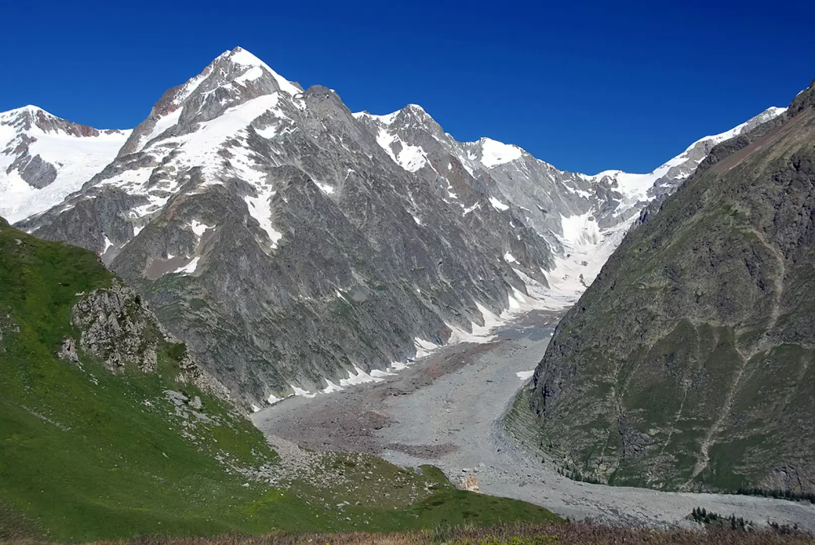
The Miage Glacier covers the southern slope of Mont Blanc, in the Mont Blanc range of the Alps, and flows down a side valley of the Val Veny in the Courmayeur area. It is formed by the confluence of the Bionnassay, Dôme and Mont Blanc glaciers, and is over 10 kilometres long. It is the largest black glacier in the Italian Alps: in its lower reaches, the glacier tongue disappears beneath an extensive layer of rock debris, whilst in the upper section crevasses and seracs remain visible. The glacier front, with its characteristic trilobed profile, occupies a section of the Val Veny valley floor.
Description
The glacier extends along the southern flank of the Mont Blanc massif, fed by the confluence of three major glacial bodies — the Bionnassay Glacier, the Dôme Glacier and the Mont Blanc Glacier — which descend from the high-altitude cirques to join as a single valley tongue. The accumulation basin reaches an altitude of 4,810 metres, whilst the glacier front lies at 1,737 metres (2019 survey): a vertical drop that ranks the Miage amongst the largest valley glaciers in the Italian Alps, with an area of 10.39 km² and a length of 10.3 km.
In its upper reaches, the surface remains exposed, criss-crossed by crevasses and seracs; from an approximate altitude of 1,800 m, the glacier tongue disappears beneath a continuous layer of debris, which extends to over 2,400 m and covers more than half of the ablation basin. This configuration — a white glacier in the upper section, entirely masked by rock debris in the lower section — earns the Miage the designation of a ‘Himalayan’ glacier, one of the largest black glaciers in the Alps.
On the right-hand side of the glacier front lies a proglacial lake, the extent of which varies seasonally depending on the meltwater inflow and episodes of boulders breaking away from the terminal ice cliff that overlooks it directly. Meltwater feeds the river system of the Val Veny.
The glacier terminates at the valley floor of the Val Veny with a broad, trilobed front. From the Italian side, it provides access to both the Francesco Gonella Mountain Hut and the Durier Mountain Hut, as well as to the Col de Miage on the French side.
Information
Visitor information
The period during which the glacier surface is accessible roughly coincides with the opening season of the Gonella Mountain Hut (1 July – 7 September), when the route conditions are most clearly visible. However, weather conditions, remaining snow cover and the state of the crevasses must be checked on site before the ascent, as these vary from year to year.
Safety notice: access to the surface of the Miage Glacier is a mountaineering activity, not a hiking activity. The glacier tongue features crevasses and serac zones, with conditions varying according to the season and remaining snow cover; it requires experience of glacier travel and, in the sections indicated in existing reports, mountaineering equipment.
General information
Official name and variants: Miage Glacier (French: Glacier du Miage)
Glaciological register code: CGI No. 213 — Register of Italian Glaciers / Register of Glaciers of the Aosta Valley
Mountain range: Graian Alps → Mont Blanc Alps
Municipality: Courmayeur
Region: Aosta Valley
Aosta
Mountain range: Graian Alps → Mont Blanc Alps
Municipality: Courmayeur
Region: Aosta Valley
Country: Italy
Predominant aspect: SE
Feeding: direct, avalanches
Maximum basin elevation:
Aosta
Country: Italy
Predominant aspect: SE
Feed sources: direct, avalanches
Maximum basin elevation: 4,810 m
Maximum glacier elevation: 4,669 m (2019)
Minimum glacier elevation (front): 1,737 m (2019)
Area: 10.39 km² (2019)
Maximum length: 10.3 km
Catchment and: Dora di Val Veny and then the Dora Baltea
Type (Shape): valley glacier
Debris cover: black — over 50% of the ablation tongue covered by rock debris, roughly from 1,800 m to 2,400 m
Recent trend: retreating
Date of data update: 2019 (Valle d’Aosta)